
Follow Us on Facebook!

INTRODUCING THE 2025 - 2026 MBGS EXECUTIVE COMMITTEE MEMBERS
-
President: Andrea Munoz-Hernandez, Ph.D., GISP. Mich. Dept. of Environment, Great Lakes and Energy
-
Vice President: vacant
-
Secretary: John Yellich, Michigan Geological Survey
-
Treasurer : Peter Rose Michigan Department of Natural Resources
-
Business Manager: Peter Rose, Michigan Department of Natural Resources
-
Past President: Jennifer Trout, Michigan Geological Survey
-
Newsletter Editor: Arlene Anderson-Vincent, Blue Triton Brands
-
Webmaster: John Esch, Michigan Geological Survey
-
Interim Field Trip Directors: John Esch & Chris Christensen
MBGS has monthly meetings typically on the 2nd Wednesday
of each month from September - May
ACCEPTING APPLICATIONS FOR THE 2026 MBGS E.Z. MANOS MEMORIAL SCHOLARSHIP
Michigan Basin Geological Society will award two scholarships up to $500 each to students conducting graduate or undergraduate research in geology related to Michigan. The scholarships will be awarded at an upcoming MBGS meeting and the winner(s) will be notified In December. We hope recipients can attend a spring MBGS meeting to present their research topic. Candidates should complete and submit the MBGS scholarship application form by December 20, 2025 to John A. Yellich, MBGS Secretary, at jasty98@aol.com with subject Line: MBGS Scholarship 2026. Applications can be found on MBGS’s Scholarship Page
OTHER NEWS: MBGS HISTORICAL PUBLICATIONS ARE NOW AVAILABLE ON USB FLASH DRIVES (8GB).
MBGS Publications ‐ There are two (2) new publications available! See details on the Publications page
MBGS On-line Store - Shop for shirts, hats, bags and other items. Check it out at: http://www.cafepress.com/mbgs
MBGS MEMBERSHIP DUES
MBGS continues to strive to provide a platform for geologist and environmental professionals to connect and offer learning and field trip opportunities. For 2025-2026, our annual dues are $35. Student Membership is free. Email any one of our officers if you are a student and would like to be a member. We now offer the option to renew your professional membership via PayPal. Please refer to the renewal notices that are included in the newsletter. Student Membership is free.
Professional Membership Dues

Opportunity for Members: MBGS is seeking members who are interested in getting involved. We need a Vice President, Treasurer, and a Secretary for the 2025-2026 year. If you are interested in these opportunities, please reach out to any of the executive committee members.
Opportunity for Presenters: MBGS is seeking presenters for Michigan Basin geologically-related topics for our 2025-2026 membership meetings. If interested, please contact Andrea Muno-Hernandez at munozhernandeza@michigan.gov.
Next Meeting
Please join us for the Michigan Basin Geological Society’s membership meetings for the 2025-2026
MBGS free virtual membership meeting on Wednesday January 14th, 2026, 7:00 PM - 8:00 PM
Virtual meeting instructions are in the meeting notice
Speaker: Jane Hearon, United States Geological Survey, Central Energy Resources Science Center, Denver, Colorado
Topic: Mapping Geologic Hydrogen Prospectivity in the Conterminous United States
ABSTRACT: The geologic and geophysical inputs necessary for the favorability mapping of geologic hydrogen systems are presented here
in support of the U.S. Geological Survey's efforts to create the first map of geologic hydrogen prospectivity in the conterminous United
States. The geologic hydrogen system model has several components that are required for a viable accumulation: 1) a source of natural
hydrogen, 2) a reservoir to store hydrogen in the subsurface, and 3) a competent seal to retain the hydrogen and prevent leakage to the
Earth’s surface. In total, there are 21 geologic layers in the model and the distribution of chance of success values are assigned to each
layer based on our interpretation of the geologic hydrogen model and our comprehensive knowledge of the United States’ geology.
The geologic hydrogen source component is divided into three sub-components comprising serpentinization-type water reduction
sources (SP), radiolysis of water sources (RD), and deep mantle sources (DP). Layers within the SP sub-component include: 1) an area
defined by a magnetic anomaly in the offshore, eastern United States, 2) onshore areas where ultramafic rocks are present at the surface,
and are inferred to extend into the subsurface, and 3) deep subsurface areas that have high-amplitude, positive gravity anomalies. Layers
within the RD sub-component include 1) areas with known uranium deposits, 2) areas that are favorable for the concentration of uranium,
3) areas underlain by the Precambrian cratonic platform, and 4) areas that are underlain by accreted terranes and contain Phanerozoicage,
granitic rocks at the surface. Layers within the DP sub-component include 1) areas of mapped, km-depth scale surface faults, 2) areas
of Paleoproterozoic-age suture zones, and 3) areas of modeled, deep crustal boundaries interpreted from geophysical data. Finally,
migration pathways were applied to specific source component layers. Regional-scale hydrogen migration pathways are derived from the
basement topography, and consumption of hydrogen during migration is accounted for by diminished prospectivity with increased
migration distance.
The reservoirs and seal components are split between sedimentary (e.g., siliciclastic, carbonate) and crystalline rocks (e.g., igneous,
metamorphic) based on high-resolution, surface geologic maps of the United States. An additional seal layer accounts for areas where salt
is present within the subsurface. A final layer includes areas where sedimentary basins contain thick (i.e., >1,000 feet) accumulations of
both porous reservoir rocks and impermeable rocks for geologic hydrogen storage and seal, respectively.
Collectively, these layers comprise the geologic inputs for the first edition of a geologic hydrogen prospectivity map of the
conterminous United States.
BIOGRAPHY: Jane Hearon is a geologist with the U.S. Geological Survey in Denver, Colorado. She currently conducts regional-scale research
and resource assessments on both petroleum systems and geologic hydrogen. Jane has worked in a variety of geologic settings throughout
her 15-year career, from sediment-hosted gold deposits to deep-marine depositional systems. Jane's research spans both hard- and softrock
geology, and she has expertise in reservoir characterization, sedimentology and stratigraphy, mineralogy and core analysis, reservoir
quality modeling, and natural resource assessments. She holds degrees from Cornell University (BA) and Colorado School of Mines (MS and
PhD).
Go to Presentations page for recent MBGS presentations as PDF files
Below are links to recordings of the past (3) MBGS meetings
A 3-D Bedrock Geologic and Hydrostratigraphic Model of Southern Ontario
Date: April 13th, 2022
Meeting Recording:
Below are the 2 original presentations that Terry presented:
A Revised 3-D Geologic Model of the Bedrock of Southern Ontario and Progress on Development of a 3-D Hydrostratigraphic Model
https://www.youtube.com/watch?v=H0VZLNMxpKU&list=PLdapv5BeduhV3JoX6F4giIHGRgYI6Bkag&index=2
A 3-D Bedrock Hydrostratigraphic Model of Southern Ontario
https://www.youtube.com/watch?v=GgJmOHYZtak&list=PLdapv5BeduhXJZedclmAYiccOCcSuYsMW&index=20
Articles referenced in the presentation:
A Hydrostratigraphic Framework for the Paleozoic Bedrock of Southern Ontario
https://journals.lib.unb.ca/index.php/GC/article/view/31465/1882527052
A Three-Dimensional Geological Model of the Paleozoic Bedrock of Southern Ontario, Groundwater Resources Study 19 Geological Survey of Canada, Open File 8618
http://www.geologyontario.mndm.gov.on.ca/mndmfiles/pub/data/imaging/GRS019//GRS019_Report.pdf
Lake Michigan Shorelines, Catastrophic Failure or Stable, That is the Question, Date: Jan 12, 2022
Meeting Recording:
https://us06web.zoom.us/rec/share/-Gr3efOHXLqk_SSFJqsMG9VpAk8sbQc9WWZDroawji1DYfjnD84IfzTSsc3XYh78.zXGywtGcpy1j0c_B
Grand Canyon MBGS Field Excursions, Date: Feb 9, 2022
Meeting Recording:
Geology in the News
New Survey Publication – An Updated Bibliography of Michigan Geology
John Yellich and Peter Voice, Western Michigan University Department of Geological Sciences and Michigan Geological Survey
The Michigan Geological Survey is proud to announce a new publication: Michigan Geology: A Bibliography, the second volume in the Michigan Geological Survey Data Compilation Series. This updated compilation lists over 7,700 references from all known Michigan sources, including industry, professional associations and universities and includes publications from 1818 to present. This report documents 200 years of Geological Research in Michigan. The Bibliography is sorted into four general categories – Precambrian, Basin, Quaternary, and Other.
This updated version of the bibliography also includes a short section on Michigan Stratigraphic Nomenclature, as well as brief discussion of historical trends in publication frequency in Michigan.
The report is free to download at the Michigan Geological Survey’s webpage: https://wmich.edu/geologysurvey/research/publications.

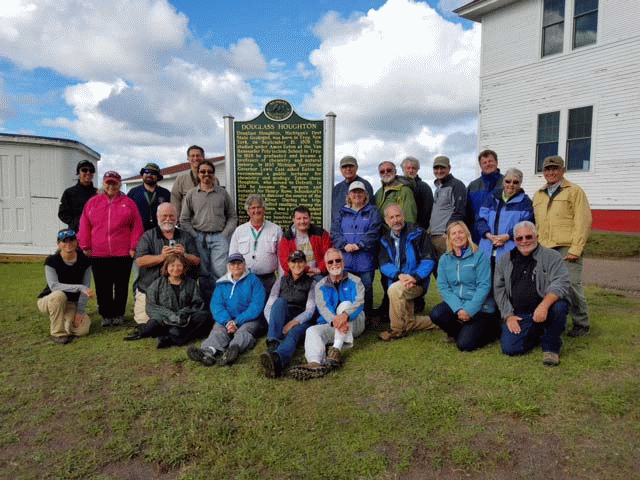
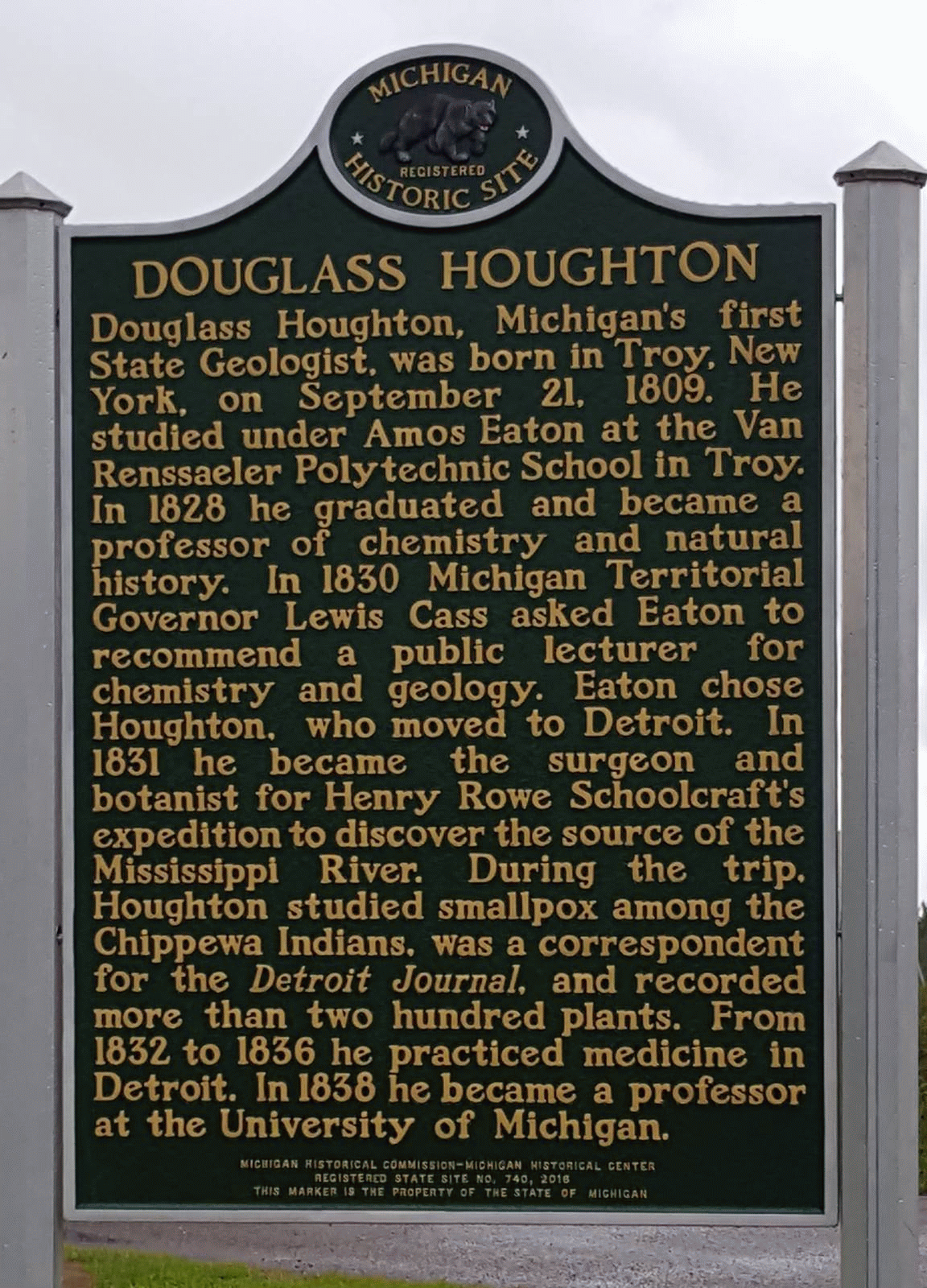
DOUGLASS HOUGHTON MEMORIAL
Douglass Houghton, Michigan’s first State Geologist, was honored on September 10, 2016 by
the placement of a State of Michigan Historical Marker commemorating his accomplishments. The
effort was led by Arlene Anderson‐Vincent, members of the Michigan Basin Geological Society,
Keweenaw County Historical Society and faculty at Western Michigan University and Michigan
Technological University. The dedication was incorporated into a MBGS field excursion led by
Professor Ted Bornhorst of Michigan Technological University and Lawrence Molloy, President of the Keweenaw County Historical Society. The two led a field excursion that covered the geology and history of sites from Houghton to Copper Harbor and wove a tale of the rise and fall of mining in the copper range. The field excursion included the dedication of the marker, which is located in Eagle River, Michigan at the Keweenaw County Historical Museum. The dedication had many speakers and a special appearance from Kyle Bagnall, who portrayed Bela Hubbard who told the story of Douglass Houghton’s 1840 expedition along Lake Superior. Douglass Houghton died in 1845 when the boat carrying himself and his crew capsized during a storm on Lake Superior near Eagle River.
Michigan Basin Geological Society


The Michigan Basin Geological Society (MBGS) was founded in 1936 as an affiliated non-profit organization of the American Association of Petroleum Geologists (AAPG) to provide a forum for the exchange of ideas relating to the field of petroleum geology through field excursions and meetings.
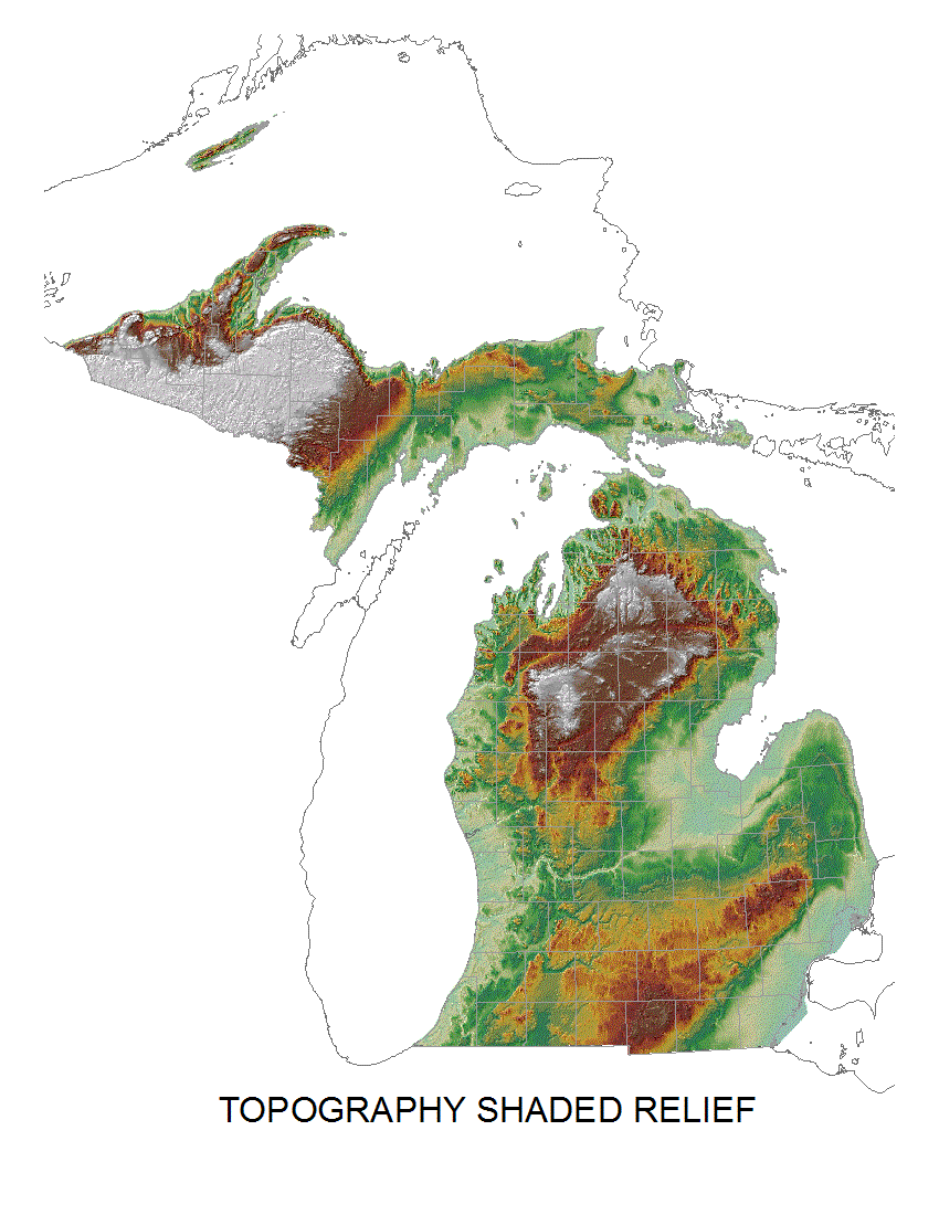
Throughout the years, the role of the society has changed, and both meetings and field excursions now address a wide range of topics pertaining to the study of geology of Michigan and the great lakes area, and is open to anyone interested in geology.
MBGS has monthly meetings typically on the second Wednesday of each month from September through May. These meeting consist of a lecture on a wide variety of Michigan geology related topics. The meetings are open to all. The Executive Committee Officers meet prior to the meeting to discuss Society issues and is open to anyone interested in attending. The society has 1-3 geological field trips per year.
MBGS members are geologists, work in a geology related field, or are a geology student or hobbyist. The Society is dedicated to the advancement of the science of geology and related fields, disseminating knowledge of geology or related fields for the benefit of its members, and promoting the education of geology in Michigan. Annual dues are $35 per person and $10 per student.
Upcoming Events
Janurary 14, 2026, MBGS Membership Meeting, Jane Hearon (USGS) virtual presentation on geologic hydrogen
June 16-17, 2006 AIPG Michigan Section 15th Annual Environmental Risk Management Workshop, RAM Center, Roscommon, Mi
EGLE Calendar of Training and Workshops
https://www.michigan.gov/egle/0,9429,7-135-3308_3333---,00.html
Michigan State University, College of Natural Science, Department of Earth and Environmental Science,
Events https://ees.natsci.msu.edu/events/
Michigan Tech – Geoseminars ‐ http://pages.mtu.edu/~raman/SilverI/Geoseminar/Welcome.html
University of Michigan Earth and Environmental Science
Events https://lsa.umich.edu/earth
Western Michigan University, Geological and Environmental Sciences
Events https://wmich.edu/geology/events